General overview of Ha Giang
Ha Giang is a province of Vietnam located in the northern region, bordering Lao Cai and Cao Bang. This place has a total area of more than 15,000 km2. As a mountainous province, Ha Giang possesses extremely dangerous terrain with many rolling mountains with altitudes ranging from 800m to 1200m above sea level. In particular, this place is also the area with the second highest concentration of mountains in the country.
Currently, Ha Giang province has 01 city, 10 districts, 5 wards, 13 towns and 117 communes with a total population of about 1 million people. The people in Ha Giang are mostly ethnic minorities such as the Tay, Mong, Dao, Nung, La Chi, Lo Lo, etc. Each ethnic group has its own, extremely unique cultural beauty.
The weather in Ha Giang has two distinct seasons: rainy season and dry season. The rainy season lasts from May to September. The dry season takes place from October to April with temperatures often very low and snow in some areas. The average temperature in Ha Giang tourist area is about 20-25 degrees Celsius in spring and autumn, and in winter it is about 15-20 degrees Celsius.
Ha Giang tourist area possesses a very unique and impressive beauty that is hard to match anywhere else. Therefore, this place is always the top tourist and discovery destination of the Northeast region – Vietnam. Because Ha Giang is not only beautiful in its majestic natural mountain scenery. Each season has a different flower color. It also brings together diverse cultures and attractive national identities. Accompanied by winding mountain passes along the mountainside, many people want to conquer.
Introducing Ha Giang tourism in different seasons and months of the year
Ha Giang province is beautiful all year round, you can travel here or take your backpacking trip at any time of the year. However, to fully explore the beauty of this rocky plateau, you should come to Ha Giang tourist area at the following times.
Spring is the season of blooming flowers
January, February: The colors of peach blossoms, plum blossoms and yellow mustard flowers bloom
Spring comes, everywhere from Quan Ba district (Quyet Tien, Minh Tan), Dong Van (Pho Bang, Pho Cao, Sung La, Sa Phin, Thai Phin Tung), Yen Minh (Lao Va Chai, Na Khe, Bach Dich ), to Meo Vac district (Sung Tra, Sung Trai, Lung Phin), a place covered with pink peach blossoms, white plum blossoms, and yellow mustard flowers blooming on the black stone floor of the rocky plateau, with rows of houses. The wall has a rustic and peaceful appearance
Summer is the season of rain
April, May: Falling water season
Most fields in the Northwest region flood in May and June, a few places will flood in July, and a few fields can store water from April.
According to the introduction of Ha Giang tourism to Ha Giang at this time, you can see the scenes of terraced fields that follow each other in layers, each layer is picturesque in the pouring season: Quan Ba twin mountains, Hoang Su Phi or the small fields dotted along Ma Pi Leng pass…
Ha Giang’s autumn season changes color
September, October: Ripe rice season
Introducing Ha Giang tourism in September and October. This is the time when Ha Giang’s weather has transformed into autumn, the images of terraced fields and valleys at the foot of the pass are covered with a new golden coat. Bright and picturesque, making many people feel moved.
Winter is the most beautiful season of the year
October, December and December: Buckwheat flower season
From the end of October until December, Ha Giang attracts a large number of tourists coming here to see buckwheat flowers. Purple and pink buckwheat flowers spread across the hillsides, creating a poetic, gentle and attractive scene.
Introducing Ha Giang tourism about the most beautiful and famous places
Dong Van Plateau
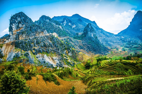
Dong Van Stone Plateau (Dong Van Plateau) is a stone plateau spread over 04 districts: Quan Ba, Yen Minh, Dong Van, Meo Vac. The Stone Plateau was officially recognized by UNESCO as a Global Geopark on October 3, 2010.
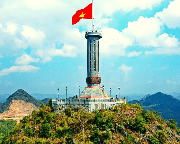
Lung Cu flagpole
Lung Cu flagpole is located on Lung Cu peak, about 1,700m above sea level, in Lung Cu commune, Dong Van district, Ha Giang province. To conquer Lung Cu flagpole, you will have to pass 140 impressive spiral steps.
Lung Cu flagpole has an architectural feature imbued with our country’s culture. The column has an exact height of 33.15m. The column’s body is built in an octagonal shape similar to the Hanoi flagpole. In particular, the base and pedestal of the column are attached by 8 blue stone relief panels depicting the patterns on the Dong Son bronze drum surface.
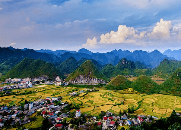
Heaven’s Gate and Quan Ba Twin Mountains
Quan Ba Heaven Gate is about 1500m above sea level, this is the first gateway to Dong Van plateau. In 1939, people built a giant door made of crushed wood with a thickness of 150cm right at the Heaven Gate. Once upon a time, behind this wooden door was another “world”, also known as the “Autonomous Region of the Meo people”, including districts such as Quan Ba district, Meo Vac district, Yen Minh and Dong Van district.
Quan Ba Twin Mountain is located right next to Highway 4C, about 40 km from Ha Giang town. Between the rocky mountains and endless terraced fields, two strangely shaped mountains emerge, making all visitors amazed by the majestic beauty of creation. These two mountains are associated with the poetic legend of Co Tien Mountain.
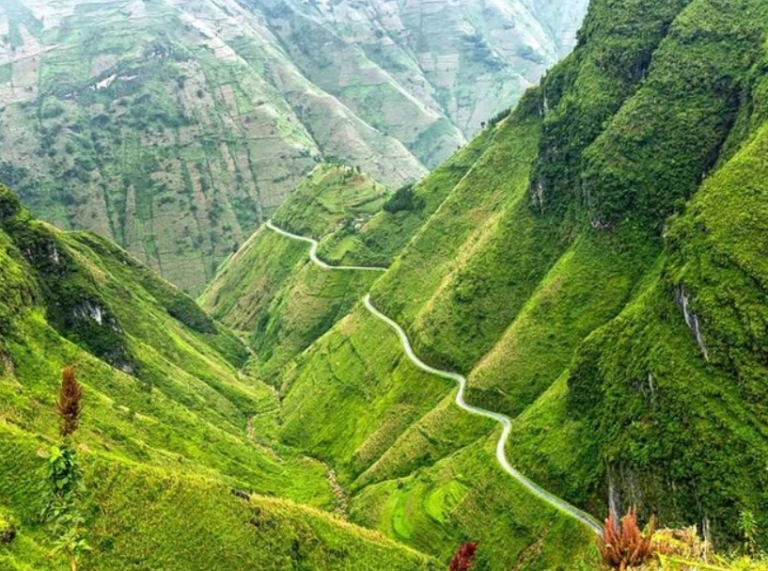
Ma Pi Leng Pass
Ma Pi Leng, the name in Quan Hoa language literally means “the bridge of the horse’s nose”. Figuratively, this name represents the most dangerous of the mountain peaks, where mares climbing to the top have miscarriages and die, where the slope is so steep that the horse passing through has to stop breathing, or the peaks The mountain is as steep as the bridge of a horse’s nose. However, according to some local H’mong people, the correct name of the pass is Mao Pi Leng, which means “the bridge of the cat’s nose”.
Ma Pi Leng peak belongs to 03 communes, including Pai Lung, Pa Vi and Xin Cai communes (Meo Vac, Ha Giang) in Dong Van karst plateau with an altitude of 2000m above sea level, created by a series of sediments. Lustrous shale, limestone, and siliceous limestone contain fossils from about 426 million years ago, including many slips and cracks caused by mountain-building activities.
The Meo King’s mansion, the name used in the documents is the Vuong Family Mansion,[1] also known as the Vuong House, is located in a valley in Sa Phin commune, Dong Van district, Ha Giang. [2] The entire Meo King mansion has an area of nearly 3,000 m2, started in 1898 and completed 9 years later, i.e. 1907. The construction process cost 150,000 Indochina white silver coins, equivalent to 150 billion VND today. .[3]
The mansion was classified as a national monument by the Ministry of Culture, Sports and Tourism on July 23, 1993.
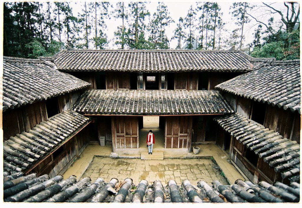
Pao’s house is located in Lung Cam cultural village in Sung La valley, Dong Van, Ha Giang. Pao’s house is about 20 km from Dong Van district, about 123 km from Ha Giang city.
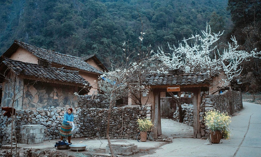
The wooden gate leads into Pao’s house, on both sides are stone walls built of stacked stones. Inside the gate are peach and plum trees. Every spring, peach blossoms and plum blossoms bloom, white and beautiful.
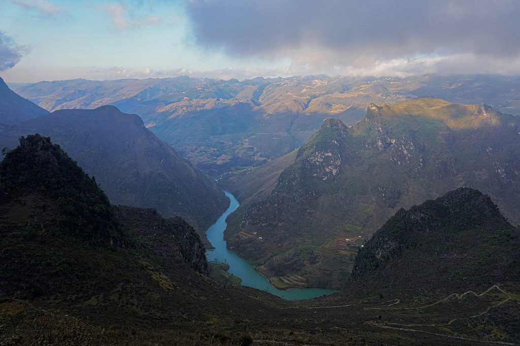
Nho Que River is a tributary of Gam River. The river originates from China and is called 南利河 Nán ì nhi (Nam Loi River) or 普梅河 Pǔ méi nhi (Pho Mai River). When it flows into Vietnam, it creates a section that is the Vietnam-China border in the polar region. north of the country in Lung Cu and Ma Le communes, Dong Van district, then flows into the interior of Ha Giang province [1].
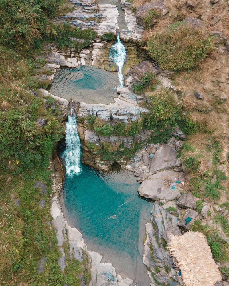
Du Gia Waterfall originates from a vast forest, carrying a clear flow through deep ravines to Tien village of Yen Minh district. In the midst of green nature, the waterfall pours down from above, creating white foam, creating a beautiful landscape that makes anyone who has ever seen it fall in love.
In addition to the above points, there are many other beautiful and majestic attractions in Ha Giang waiting for you to explore. Come with Friendly Tour to fully experience Ha Giang.


