HA GIANG LOOP – KHAU LAN WATERFALL

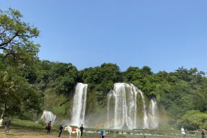
1. Explore Khau Lan waterfall in Ha Giang 1.1. Where is Khau Lan Waterfall? Where is Khau Lan Waterfall or the exact location of Khau Lan Waterfall is something that many people wonder about when planning their upcoming trip. Specifically, this waterfall is located in a valley in Quyet Tien …

HA GIANG LOOP – Ha Giang buckwheat flowers

1 .Introduction to Ha Giang buckwheat flowers 1.1 Origin of buckwheat flowers In the past, people in Ha Giang mainly used corn and rice as food to survive, but one year, the corn and rice in people's houses ran out but it was not yet time for the next crop, leading to people at that time being …

HA GIANG LOOP – KHAU VAI LOVE MARKET

The word "Khau Vai" in Tay-Nung language means "thorn pass". But many documents use it incorrectly as "Khau Vai". Tourists traveling to Ha Giang jokingly call this Phong Tinh market. The origin of this market starts from the legend of Ba from the Nung ethnic group and Ut from the Giay ethnic …

HA GIANG LOOP – TAY CON LINH MOUNTAIN

Tay Con Linh Nature Reserve has an area of ​​15,012 hectares, including 10 communes in 3 districts and cities: Lao Chai, Xin Chai, Thanh Thuy, Phuong Tien, Cao Bo, Quang Ngan, Thuong Son (Vi Xuyen); Phuong Do, Phuong Thien (Ha Giang City) and Tung San (Hoang Su Phi). Tay Con Linh mountain peak, …

HA GIANG LOOP – DONG VAN OLD TOWN

The name Dong Van is transliterated from the mandarin word "Tong Puon" meaning trading field. Historically this was the trading center of the entire large Dong Van district, the main hub for transporting opium to China. Quoc. The central area of ​​Dong Van town in the past belonged to Dong Quan …

HA GIANG LOOP – BAC SUM PASS

Bac Sum slope is a pass on National Highway 4C connecting from Minh Tan commune (Vinh Xuyen, Ha Giang) to Quyet Tien commune (Quan Ba, Ha Giang). How many kilometers long is Bac Sum slope? This is the longest slope in Ha Giang province with a length of 7km and an altitude of more than 450m. This …

HA GIANG LOOP – THAM MA PASS

The prime land of the Fatherland, Ha Giang, is blessed by nature with many breathtakingly beautiful scenes. This place has famous and majestic roads that are extremely attractive to drivers who love to experience adventure. And Tham Ma slope is one of those famous and steep roads that every visitor …

HA GIANG LOOP – NHO QUE RIVER

Nho Que River - timeless beauty next to Ha Giang's rocky mountains Nho Que River is peaceful Along with the rugged Ma Pi Leng, Nho Que River has become legendary, entered poetry and is one of the symbols of Ha Giang. Nho Que is one of the most beautiful rivers in the Ha Giang rock flower …

CAO BANG LOOP 3 DAYS 2 NIGHTS

CAO BANG LOOP 3 DAYS 2 NIGHTS

Day 1: Cao Bang-Ban Doc waterfall-Nguom Ngao cave-Tra Linh(camping) 9am start from cao bang. ( buy some food for luch ) Visit phuc Sen village to see local peoples make knives 11am arrive to the Ban Sam waterfall and have lunch and a swim at the waterfall. 2pm get on to the bike again …

CAO BANG LOOP 4 DAYS 3 NIGHTS

CAO BANG LOOP 4 DAYS 3 NIGHTS

Day 1: Cao Bang - Quang Uyen - Ban Sam Waterfall (picnic) - Ha Lang - Khuoi Ki Village. 9:00 a.m. depart from Cao Bang (buy lunch) Visit Phuc Sen village to see local people making knives 11am arrive at Ban Sam waterfall Have lunch and swim at the waterfall. At 2:00, I got on my bike …